Minnesota High Point - Eagle Mountain - 2301 ft

This was our third day of the Memorial Day Weekend Mid-West High Pointing expedition. We had left Columbus Ohio on Friday morning and heading north to bag the high points of Michigan, Minnesota and Wisconsin. Our plan was to drive to the Upper Pennisula of Michigan and stay in Marquette friday evening, bag the peak next day and then drive to Lutzen Minnesota stay overnight, summit in the Morning and head to Wisconsin.
That was our plan, reservations were made, routes mapped out, supplies obtained, the GPS programmed, but Michigan did not happen. We followed the maps and GPS and approached Mt. Arvon from the south, wrong move, the road was on the maps but when had to turn back when the GPS wanted up to make a right turn onto a road that no longer existed as a road. So we turned back and left Michigan for another day and a different approach. We wasn't able to drive close enough to attempt the summit and keep our schedule or to drive out and circle around to from the North. Since Minnesota was farther from Ohio we choose it over Michigan.
Sunday morning daybreak arrived early at 5:10 AM so I was up and out on my bike by 4:55 and did a short 10 mile ride since my other goal was to ride my bicycle in Minnesota. We then packed and left the motel and head northeast on SR 61 to CR 4 also called Caribou road. We turned left and headed north on CR-4, the high pointer book had stated that the road was only paved for the first 3.7 miles, but the county had been busy and it was paved several more miles before it turned into a gravel/dirt road. However, the road was still very good and a 45 mph was comfortable. After about 17.4 miles on CR-4 we came to a T in the road, the high pointer book said the road was Forest Road 170 and so did the sign, the GPS map called it FR 153 and so did MS Streets. But it didn't matter there was only one way to go so we turned right and followed it 3.6 miles to trail head at the junction of Bally Creek Road.
We arrived shortly after 8:00 AM and was the second car in the parking lot. We applied the bug spray (a must) loaded our packs, mostly water in the bladders, filled out a permit (also a must) and head out on the trail. At first the trail was uninteresting reminding us of other places such as Mt. Rogers and Mt. Marcy, due to the rocks and tree roots and not much to see but the trees. We we arrived at Whale lake the view was a little better but the rocks was worse. We found the sign to Eagle Mountain, turned left and up the hill. We passed the senic overview,and up to the top.
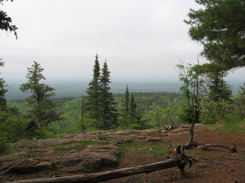
Weather was moving in and we was in a hurry to get down so we didn't stay long and took a picture as an after though as we started down.
Down was faster than up and we met several groups heading in as we was heading out. The first group we met contained a guy from Zanesville Ohio, small world. The thunder was getting louder and the lightining was getting closer, we did not want to get caught it a downpour so we pushed the pace. It started raining just before we made the trail head but we was in the car before the heavens opened up, which it did in a big way. This caused a problem for us the next day.
We then drove to Wisconsin and submitted Timms Hill before cheching into our motel in Medford. The next day started the drive by washing the dirt off the car from the drive out. A lot of dirt, sand and small gravel came out from the wheels but as we found out latter not enough. When we hit the expressway we noticed a vibration as our speed increased. Thinking we might have hit a hole and knocked the car out of line we watched our speed, tried to stay under 75mph. The next day made an appointment with the shop and had the car checked out. The problem was not all the dirt was removed by the car wash and a section was caked on the inside of the rim and threw the tire out of balance, problem solved.
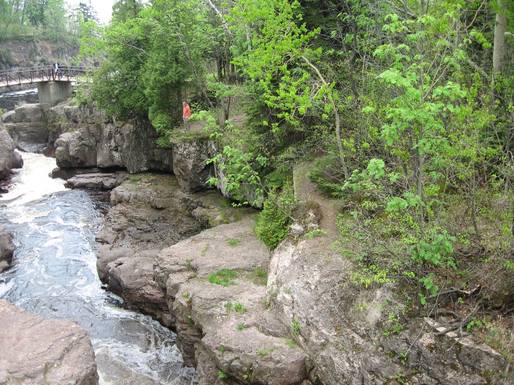
Minnesota was an interesting place, biking was good, scenary was great, plenty of waterfalls to stop and see along SR-61.